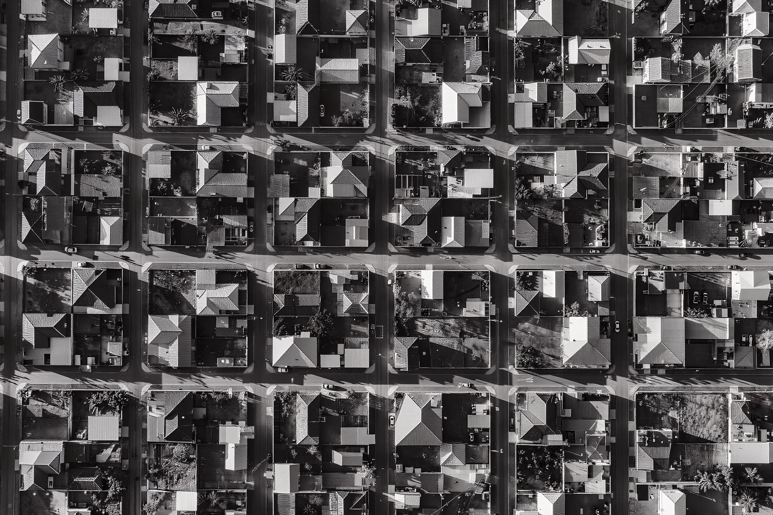
It grows every day
In 1985, the housing area in Petrópolis covered about 30 km². In 2020, that total had reached 50 km². In the same interval, the area classified as irregular and high-risk occupation went from 1.9 km² to 4.1 km². The figures come from a MapBiomas survey published in 2022 and reported by CNN Brasil in coverage of the February tragedy of that year.
The growth rhythm of the two curves is different. Occupation in areas that are irregular and at high risk of landslides and flooding grew by roughly 107% between 1985 and 2020. Occupation in the remaining areas grew 66%.
Informality outpaced the rule by a wide margin.
This is not exclusive to us
The 2022 Demographic Census by IBGE (the Brazilian Institute of Geography and Statistics) identified 12,348 Favelas and Urban Communities in Brazil. They housed 16.4 million people, distributed across roughly 6.5 million households. That is 8.1% of the country's population.
In 2010, the same survey had found 6,329 such territories and 11.4 million people, or 6.0% of the population. In a decade, the number of mapped settlements more than doubled, and the share of the population living in them grew.
Itaipava, third district of Petrópolis, is a specific slice of that national curve. Here the pressure vector has a serrano, touristic and second-home coloring. But the underlying pattern is the same: the city grows faster than enforcement and planning can keep up.
Sixty-one complaints in 2024
In 2024, Itaipava was the neighborhood with the most environmental crime complaints in Petrópolis. There were 61 records, according to the Linha Verde do Disque Denúncia program, a survey published by Tribuna de Petrópolis. The city as a whole totaled 641 occurrences for the year, 52% more than in 2023.
Among the types of environmental crime reported, irregular construction ranks fourth in the municipality, with 88 records, behind animal abuse, deforestation and irregular tree extraction.
The information matters not for the headline, but for what it says technically: occupation pressure in Itaipava is above what municipal enforcement can absorb. A complaint is a partial indicator, but it points in the direction that other indicators also point to.
The effects are not abstract.
They are drainage that fails. They are river siltation. They are slopes that slide. They are public infrastructure that has to be rebuilt because it was designed for a smaller city than the one that exists today. They are sidewalks that disappear, power that fails, tourism that loses the landscape that attracts it.
The cost of urban inaction
In February 2022, Petrópolis lived through the worst rainfall in its historical series. Over two hundred deaths. Entire areas of the first district erased in hours. Eleven years earlier, in January 2011, the Região Serrana of Rio de Janeiro had been the scene of the country's largest climate disaster by number of victims. Petrópolis was there on both dates.
When geotechnical engineer Luís Carlos de Oliveira, one of those responsible for the PMRR (Municipal Risk Reduction Plan) drawn up in 2017, spoke to CNN Brasil after the 2022 tragedy, he stated that the survey had already identified at least 15,240 households in the first district of Petrópolis as being in high and very high risk areas. It was precisely in that area that the rain killed.
Technical literature calls this the cost of urban inaction. When a city avoids the political conflict of planning and regulating occupation, it transfers the cost to the next decade, multiplied. In lives, first. In emergency works, after.
Every new house outside the plan is a deferred public expense. And deferred expense charges interest.
There are two paths
The first is to keep doing what is being done. Subdivision after subdivision approved in isolation, without a drainage network sized for the whole, without a green-area reserve, without an impact study, without conversation with the road system.
The second is technically known, legally available, and politically difficult.
It is called urban planning.
It begins with a Master Plan that has been reviewed within the last ten years, as required by article 40, paragraph 3, of the City Statute. It continues with a geotechnical chart that says, lot by lot, what can and cannot be done. It runs through the demarcation of ZEIS (Special Zones of Social Interest), the definition of basic and maximum floor area ratios, the creation of a FUNDURB (Municipal Urban Development Fund) that receives the Charge for Additional Building Rights (OODC) and returns it as infrastructure.
The toolbox has been open for 25 years
None of this is new.
The City Statute, federal Law 10.257, was enacted on July 10, 2001. It will turn 25 years old.
The toolbox has been open for a quarter of a century.
Itaipava has yet to pick up the key.
Sources consulted
accessed on: May 16, 2026
- 1. MapBiomas, Collection 7.1 (2022) · via CNN Brasil. Survey by Edmilson Rodrigues, MapBiomas urban mapping team. Growth of occupation in irregular and high-risk areas in Petrópolis (107% between 1985 and 2020), compared to general residential growth (66%); evolution of total housing areas (30 km² to 50 km²) and of subnormal clusters (1.9 km² to 4.1 km²); share of irregular occupation rose from 6.6% to 8.26%. cnnbrasil.com.br →
- 2. IBGE, 2022 Demographic Census · Favelas and Urban Communities. 12,348 Favelas and Urban Communities in Brazil; 16,390,815 people (8.1% of the population); 6,556,998 households. In 2010, there were 6,329 territories and 11,425,644 people (6.0% of the population). agenciadenoticias.ibge.gov.br →
- 3. Tribuna de Petrópolis (2025) · Itaipava is the neighborhood with the most environmental crime complaints in 2024. Linha Verde do Disque Denúncia program. 61 complaints in Itaipava, 641 in the city, a 52% increase over 2023. Irregular construction ranks fourth among the types, with 88 records. tribunadepetropolis.com.br →
- 4. CNN Brasil (2022) · PMRR (Municipal Risk Reduction Plan) of 2017. Interview with geotechnical engineer Luís Carlos de Oliveira. At least 15,240 households in the first district of Petrópolis located in areas of high and very high landslide risk. Reference to the Petrópolis tragedy of February 2022 and to the Região Serrana tragedy of January 2011. cnnbrasil.com.br →
- 5. City Statute · federal Law 10.257, of July 10, 2001. Article 40, paragraph 3: the law instituting the master plan must be revised at least every ten years. Consolidated text on the Planalto portal. planalto.gov.br →
Updated on May 16, 2026 · full rewrite under the MODO-ARSENIC-BLOG protocol