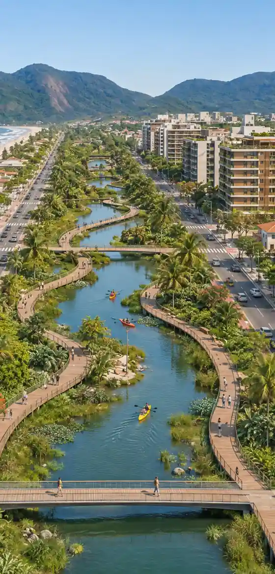
Masterplan · Itaipuaçu, Maricá / RJ
Nova Itaipuaçu
Preserving Itaipuaçu’s vitality through moderate increases in building height and density.
The video could not be started. Open the video
Chapter 01 / 06
The place
Preserving Itaipuaçu’s vitality.
The Nova Itaipuaçu Masterplan aims to create the conditions for preserving the neighborhood’s vitality through moderate increases in building height and density. The proposal brings new housing, shops and services together with infrastructure, environmental restoration and high-quality public spaces.
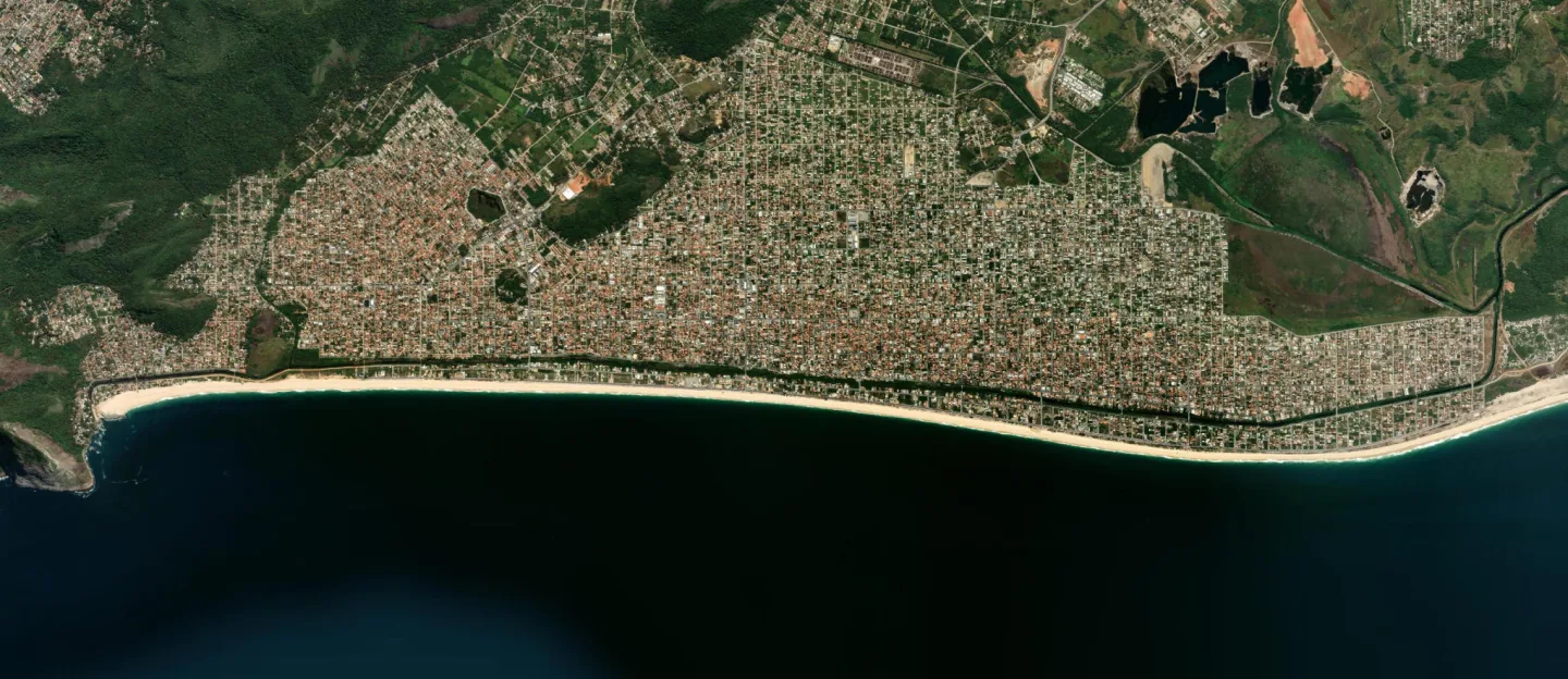
The masterplan in its territory
Credits
Image: Esri World Imagery · Esri, Vantor, Earthstar Geographics and the GIS community.
Open the area in OpenStreetMap ↗A territory that calls for integrated planning
Itaipuaçu is part of Maricá, on the coast of the state of Rio de Janeiro. The municipality recorded 197,277 residents in the 2022 Census, according to IBGE. This figure refers to the entire municipality. The district and the masterplan’s intervention area each have their own scale.
The assessment guiding the masterplan combines territorial analysis, socioeconomic research, a property market survey, urban intervention references and interviews with planning professionals. This foundation helps relate the city’s design to the conditions needed for its transformation.
The spatial analysis reveals predominantly low-rise development, an extensive seafront and a canal alongside plots, streets and the backs of buildings. The study identifies an opportunity to bring these elements together: the waterfront as a shared public space, water as part of the infrastructure, and neighborhoods as places to live, work and access services.
Chapter 02 / 06
The proposal
Maricá Net Zero Territorial.
Urban development, environmental capacity, social inclusion and the economic sustainability of infrastructure guide a shared vision of transformation.
Landscape as structure
The canal and the linear park connect the waterfront to the urban fabric.
Infrastructure and development
Moderate increases in building height and density work together with sanitation, mobility and a mix of uses.
Urban life and inclusion
Public spaces, services and different forms of housing give purpose to the transformation.
Infrastructure and development planned together
The concept translates into three decisions: prepare infrastructure to support development, direct increased density toward areas that can be served, and link real estate development to investments in the public interest. Urban design then addresses transport, sanitation, landscape and services as parts of a shared strategy.
The concept also proposes a more careful relationship with natural systems. Permeable areas, vegetation, water retention spaces and restored banks help organize the territory. Net Zero Territorial is the concept guiding this vision; it does not constitute carbon-neutrality certification.
Four parts. One integrated proposal.
Explore the relationships between the waterfront, the park, the crossings and the blocks. Each space contributes to a shared urban structure.
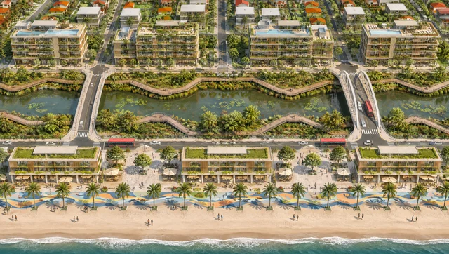
Conceptual view of the proposal · Select the numbered points
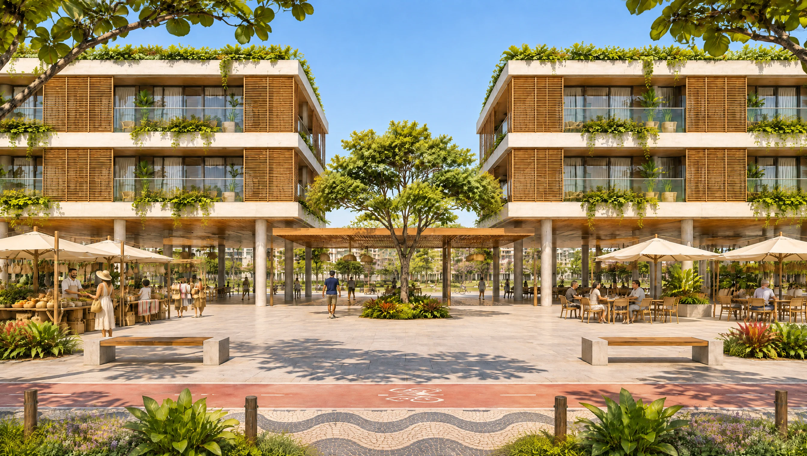
The sea is part of everyday life.
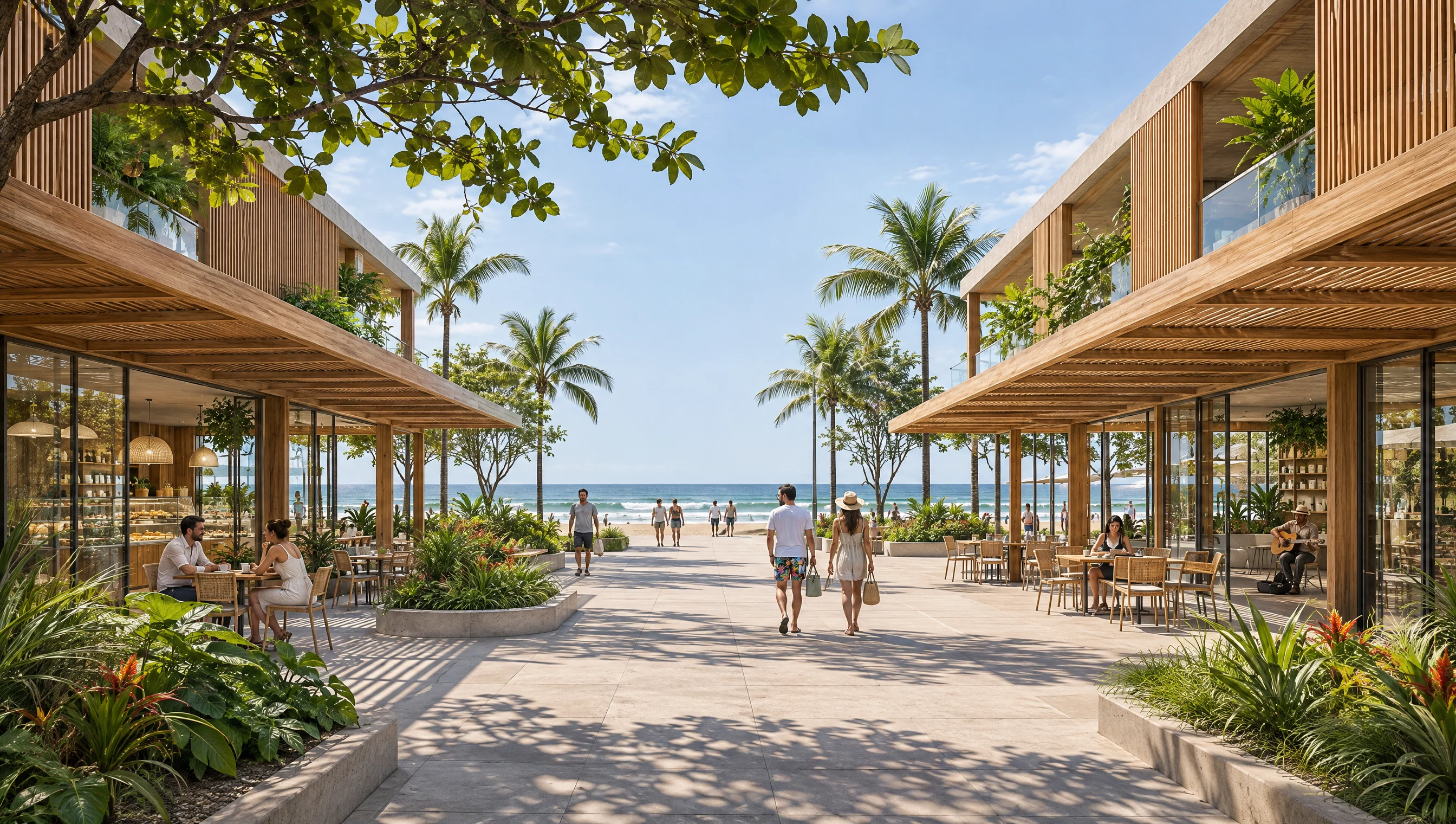
Institutional buildings, squares for events and markets, hotels and restaurants support the beach and bring activity to the waterfront. The proposal provides for an open ground floor with two floors above, to preserve views and sunlight.
Explore the proposal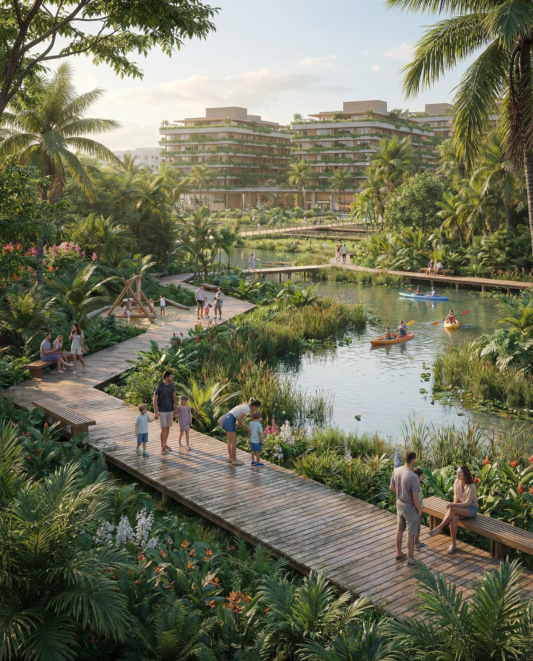
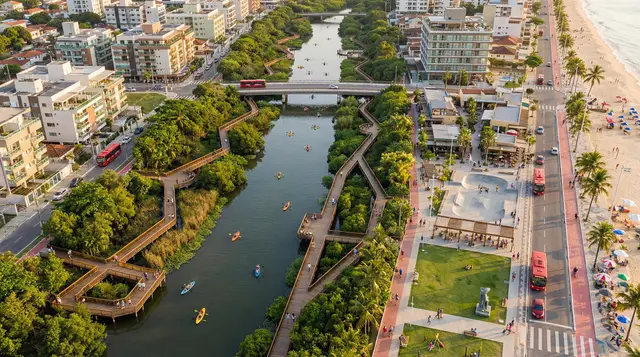
Water organizes the landscape.
The canal and its banks form the park’s central axis. Vegetation, paths and gathering spaces bring infrastructure closer to urban life.
Explore the proposal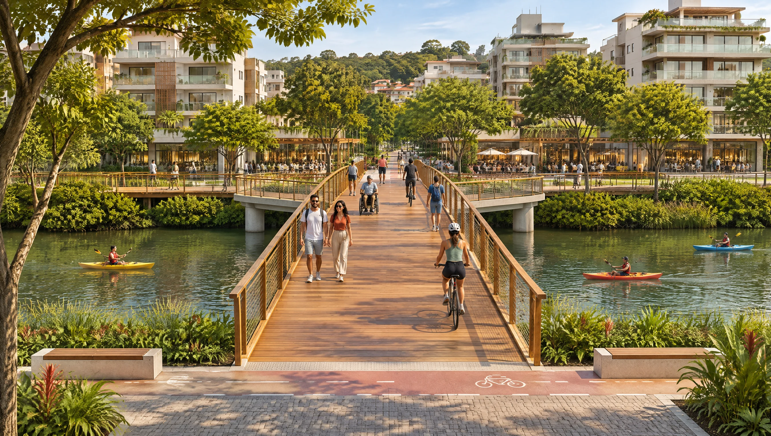
Two banks, one route.
Cross-connections link the neighborhood, the park and the waterfront. The proposal brings destinations closer together and creates continuity in everyday routes.
Explore the proposal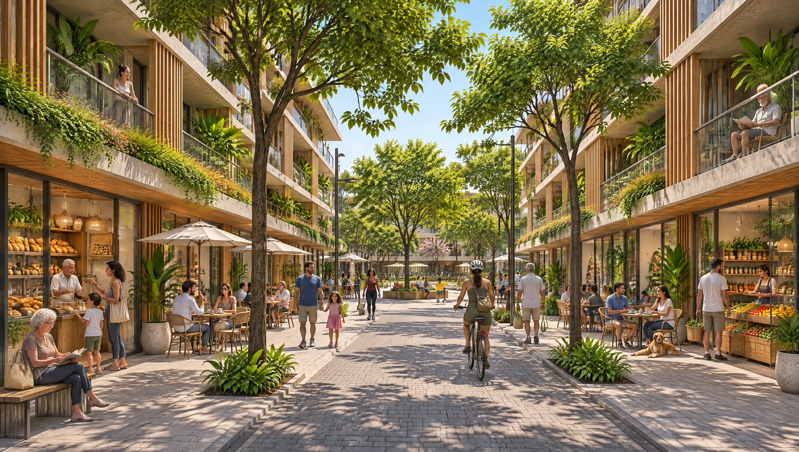
City life happens at ground level.
Residential blocks with ground-floor shops bring housing, services and public space closer together. The mix of uses encourages activity in the streets at different times, sustaining urban life throughout the day and night.
Explore the proposalConceptual modeling and perspectives. The points guide the reading of the spaces shown.
Chapter 03 / 06
Spaces and everyday life
The canal becomes a gathering place.
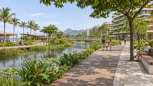
Restoring the banks makes water the central axis of a linear park, with paths, footbridges, sports and places to spend time, connected to the neighborhoods.
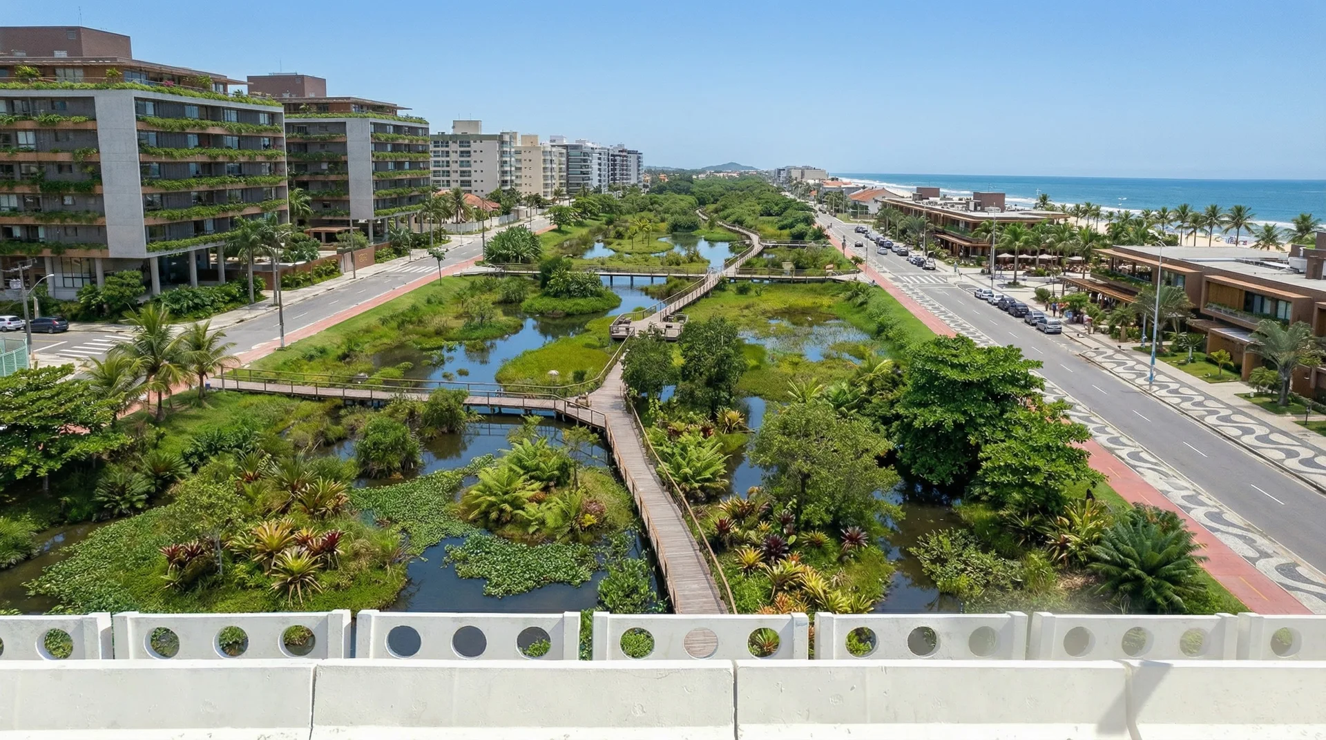
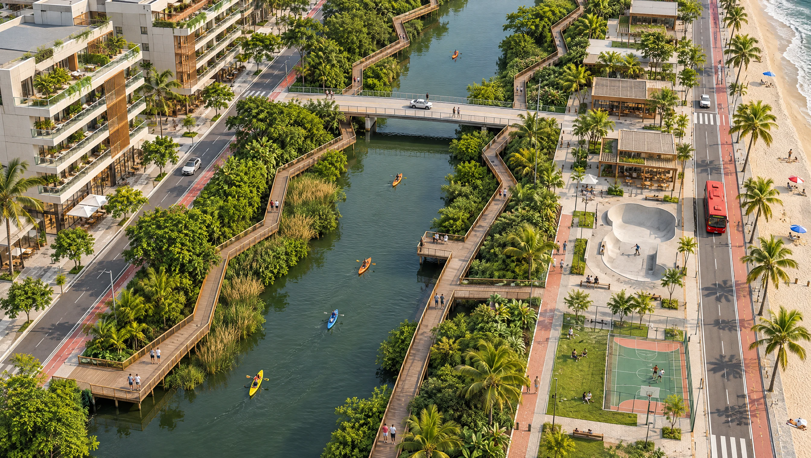
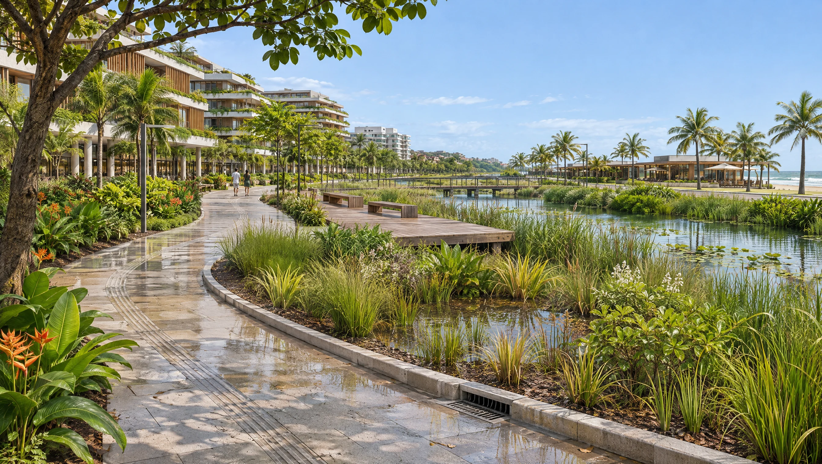
The canal as a structuring element of the city
The proposal includes banks with continuous paths, footbridges and spaces with views of the water. Landscape restoration seeks to transform a divide between parts of the neighborhood into a place for meeting and connection. The crossings bring the two sides closer and help connect the inner streets to the beach.
A continuous landscape
The approximately 12 km axis proposed in the masterplan links walking, cycling, leisure and social life across the territory.
Living infrastructure
Water restoration, sanitation, drainage, vegetation and permeable areas sustain the landscape and need to function together.
A linear park with environmental and urban functions
The park’s continuity connects public spaces and neighborhoods along the waterfront. Its route and perimeter need to be consolidated in subsequent technical stages.
Along this axis, the program combines walking, cycling, sports, social interaction, contemplation, culture and tourism-related activities. Places to spend time are distributed between the beach, the canal banks and the connections with the neighborhoods.
The park also organizes its surroundings. Continuous routes can guide the location of services, facilities and new urban frontages. To fulfill this role, it needs to provide everyday access, maintenance and integration with transport, as well as attractions for visitors.
Water, vegetation and infrastructure developed together
The masterplan works with three complementary systems. Green infrastructure brings together vegetation, parks, permeable areas and ecological connections. Blue infrastructure encompasses the canal, water bodies, drainage and their relationship with the coastal system. Conventional infrastructure includes water supply, sewage, energy, circulation and other urban service networks.
This transformation needs to go hand in hand with restoring water quality. The masterplan links the park to sanitation and treatment interventions upstream. The proposed landscape depends on functioning water infrastructure, including during heavy rain and changes in coastal conditions.
The strategies under study include rain gardens, vegetated areas that receive runoff, bank restoration and spaces that can accommodate water. The aim is to incorporate environmental functions into public space and reduce pressure on drainage systems.
These solutions require investigation of the soil, groundwater, flow rates and water quality. The sizing of vegetated areas and retention spaces must demonstrate the expected performance, with monitoring during operation.
The waterfront as public space.
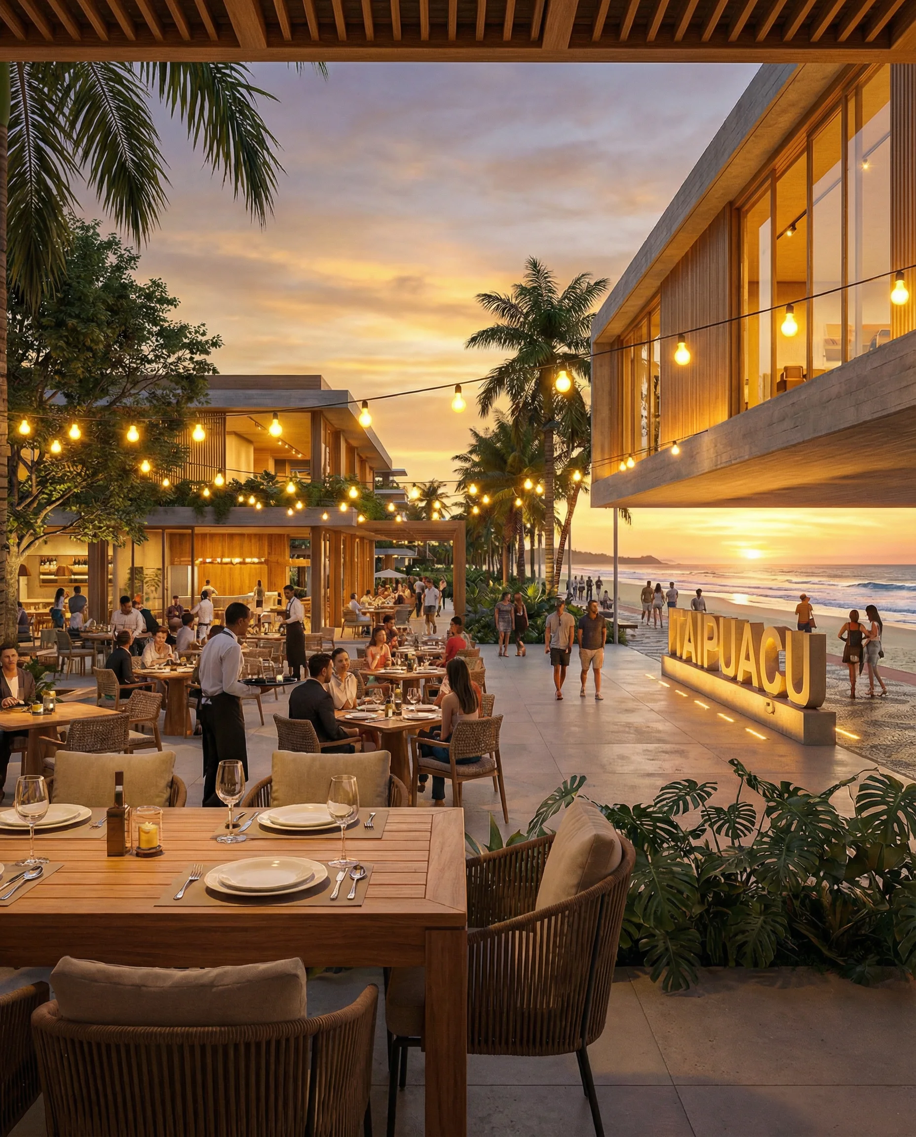
Along the seafront, institutional buildings, squares for markets and events, hotels and restaurants support the beach and keep the waterfront active at different times of day.
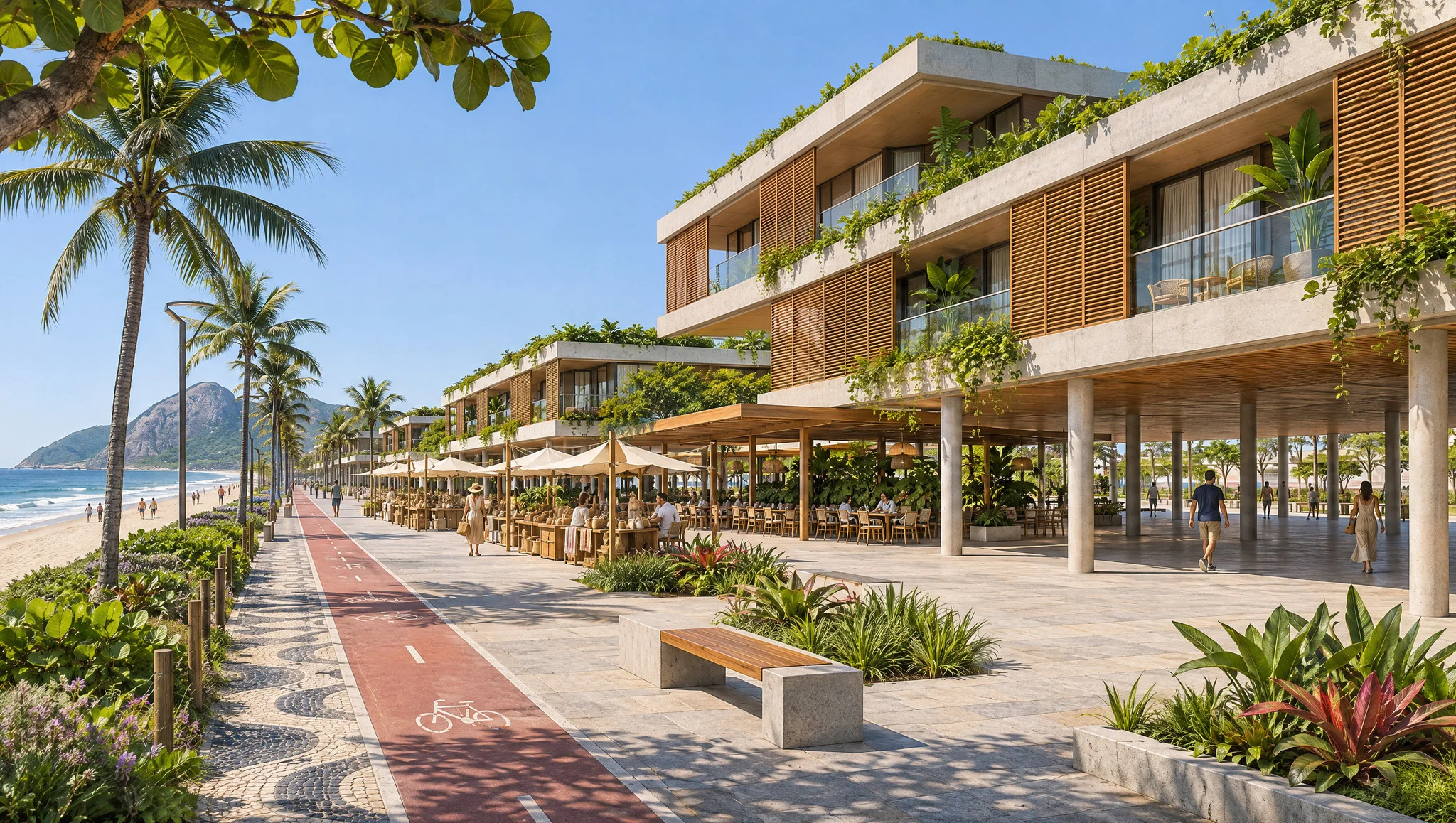
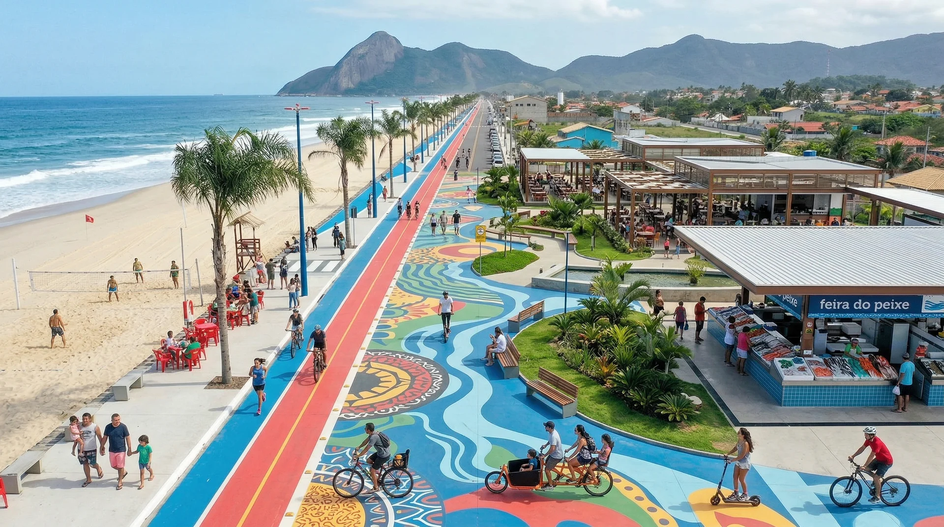
Low-rise buildings and continuous public spaces
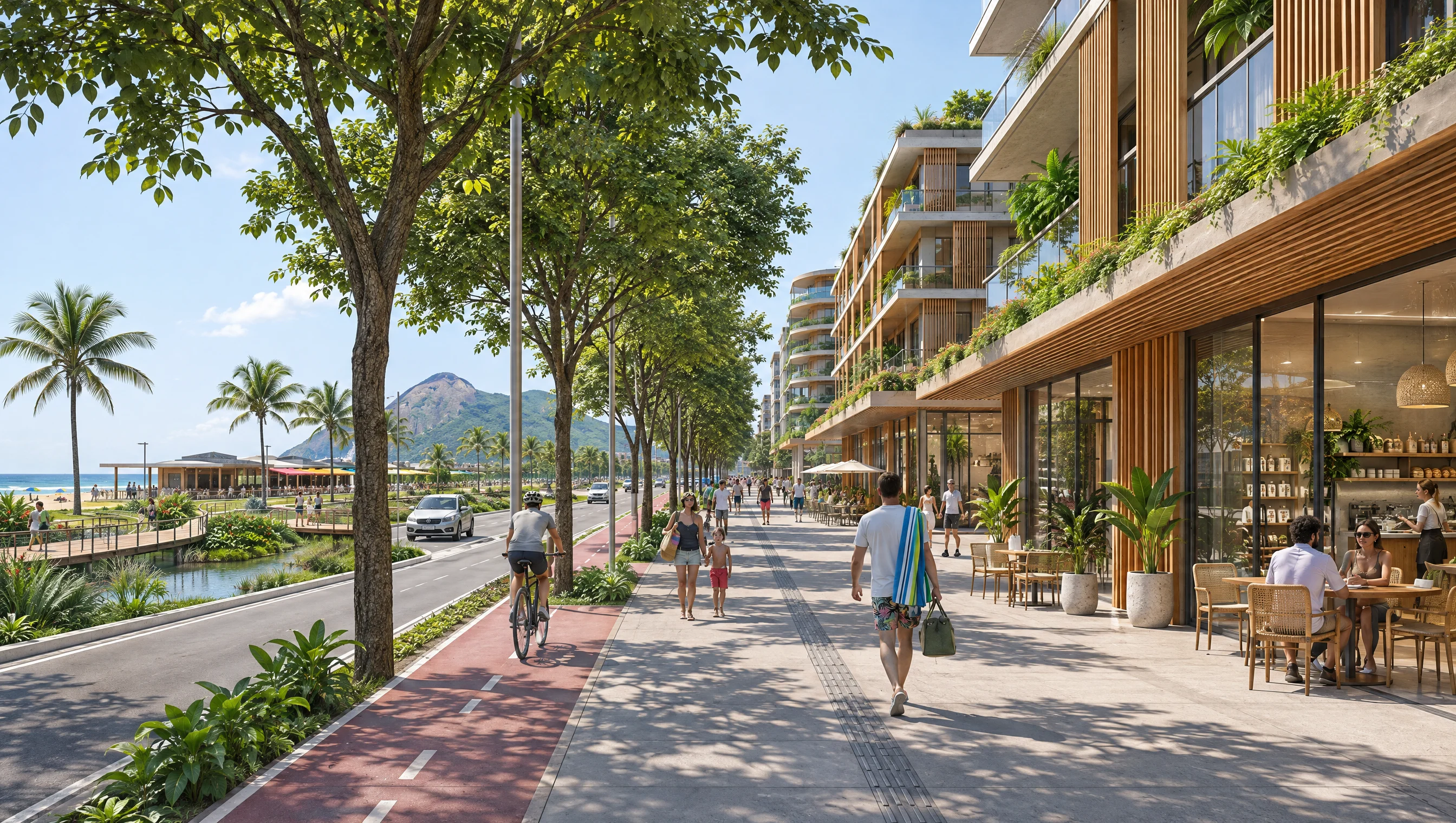
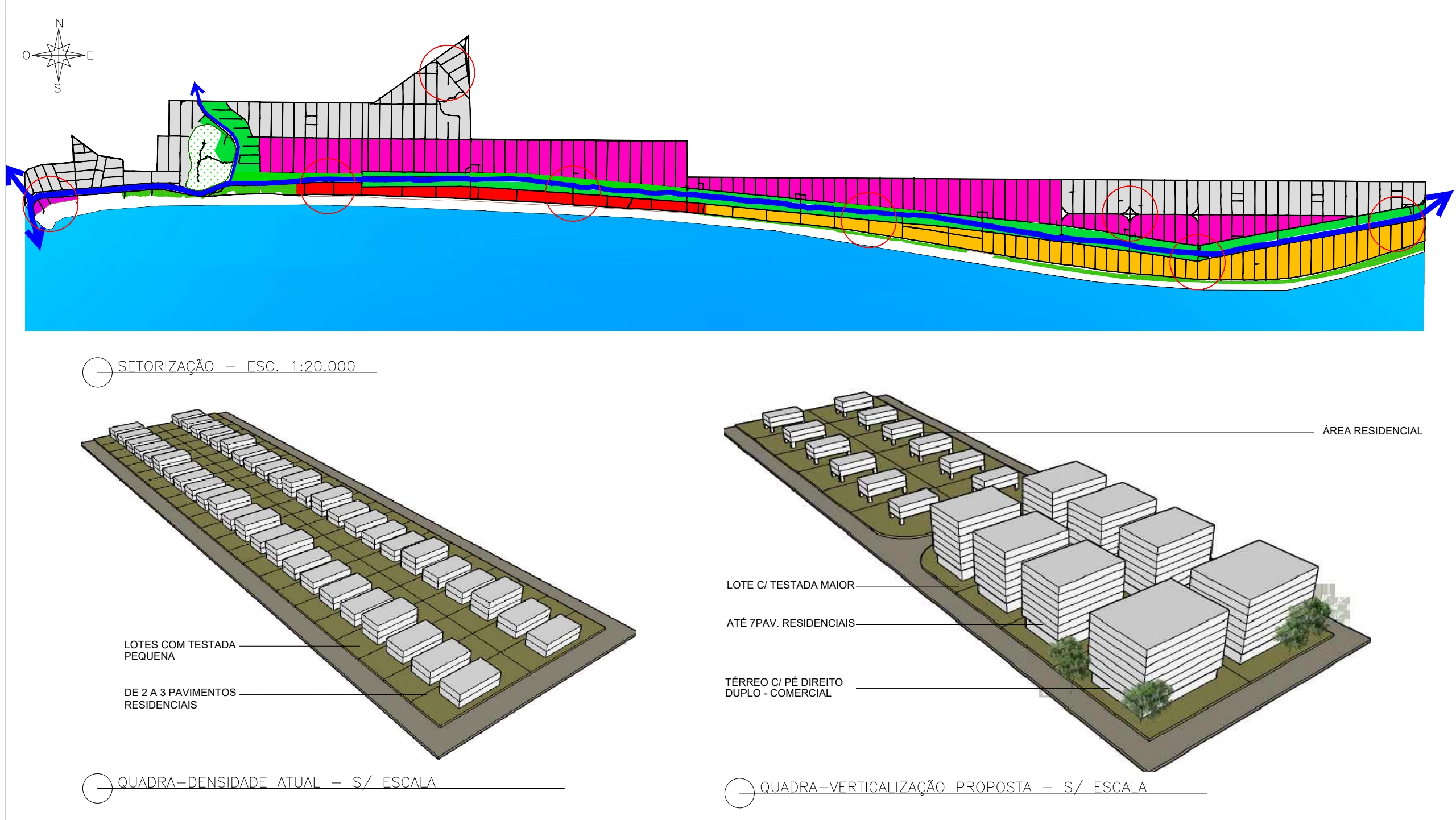
The proposed configuration, with an open ground floor and two floors above, seeks to preserve views and sunlight. Low-rise buildings alternate with squares, passageways and places to spend time, maintaining the continuity of public use along the waterfront. Wider sidewalks complete the route from the neighborhood, across the park and down to the beach.
Connect the neighborhood. Extend the routes.
Everyday mobility
Walkways, cycle paths, crossings and reorganized streets bring the inner streets closer to the beach and services.
Regional connections
The masterplan studies transport along the waterfront, a waterborne connection to Rio and alternative links to Niterói. These possibilities require further demand and feasibility studies.
From local circulation to regional connections
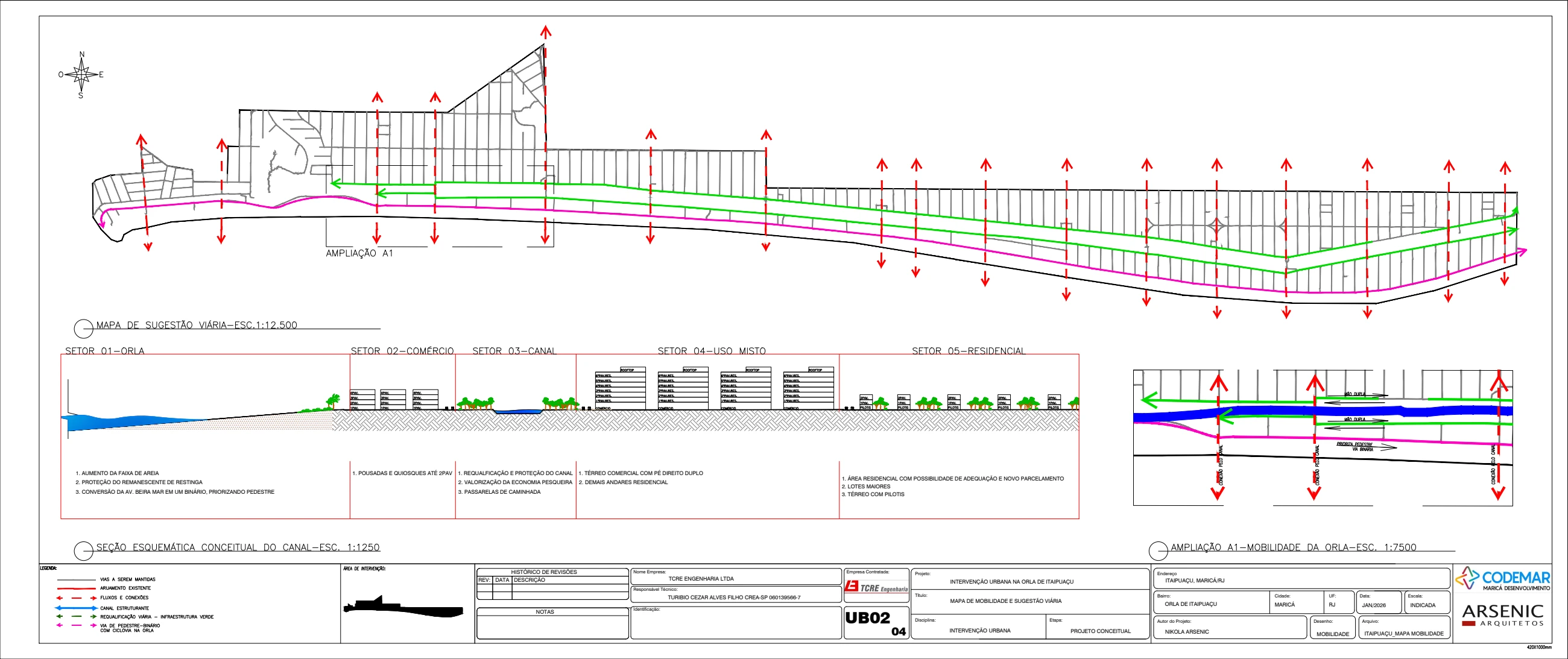
The proposal reorganizes circulation to give pedestrians and cyclists more space. The design integrates improved walkways, cycle paths, cross-connections and paired one-way streets in sections of the street network.
Paired one-way streets distribute traffic directions between complementary roads. In the masterplan, this reorganization is studied alongside reducing conflicts and creating more space for active travel and staying in public spaces. Crossings, access to services, loading and unloading, and emergency access need to be part of the same design.
The study considers integrating walking and cycling routes with public transport. The alternatives include a transport system along the waterfront, such as a people mover. The choice of technology, capacity and operation depends on specific demand and feasibility studies.
At the metropolitan scale, the masterplan studies a waterborne connection to Rio de Janeiro and alternative road links to Niterói. These possibilities seek to bring Itaipuaçu closer to regional employment, education and services.
These possibilities for metropolitan connections form part of the vision for territorial development. Developing them involves stakeholders, approvals and analyses that go beyond the waterfront’s design. Implementation dates and operating conditions depend on this development.
Living, working and enjoying the neighborhood.
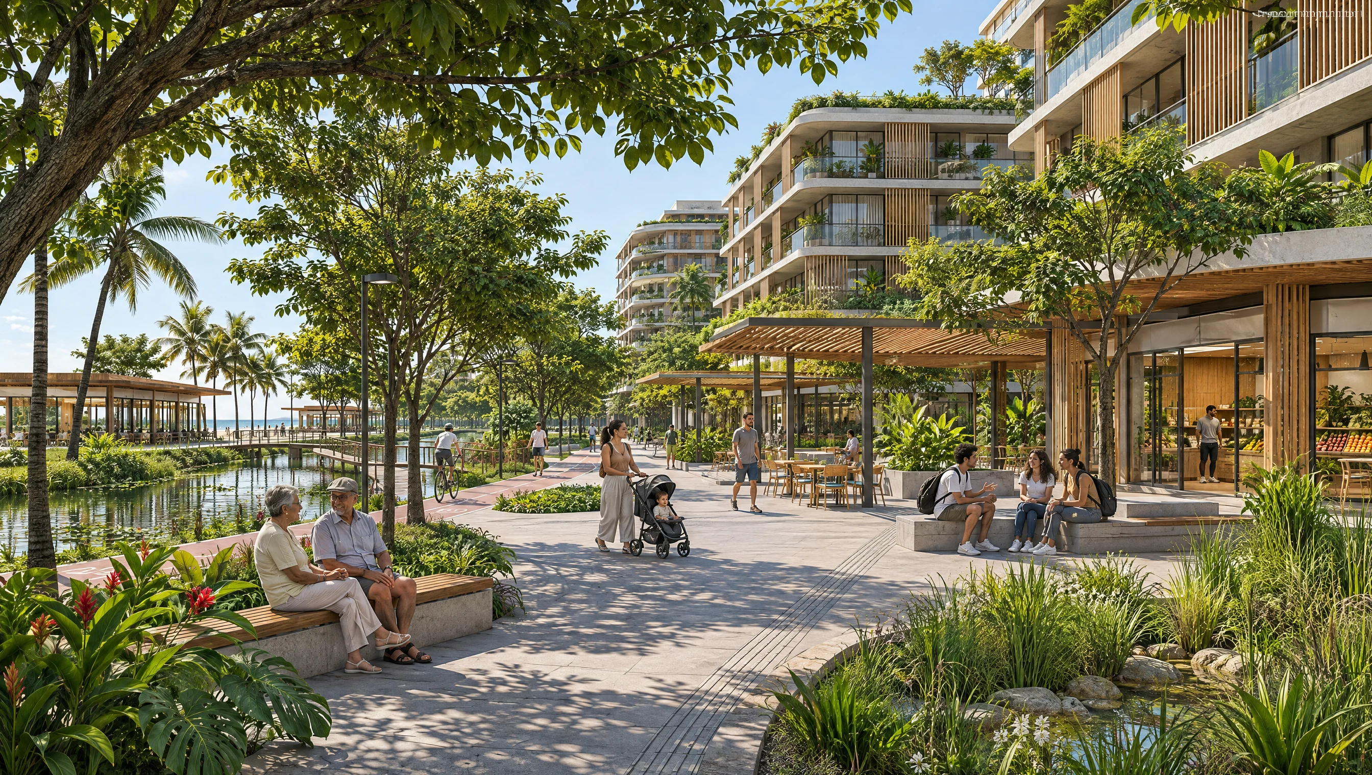
On the inland side of the canal, moderate increases in building height and density bring more residents closer to shops, services and public spaces. Residential blocks with ground-floor shops help sustain the local economy and keep the streets active at different times of day.
Different ways of living
Social housing, social rental housing, student housing and senior living form part of the proposal. The research identifies senior living as the most promising segment.
Increasing density in moderation
Moderate increases in building height and density create the conditions for sustaining the neighborhood’s vitality while respecting infrastructure capacity and environmental comfort.
Housing for different stages of life
Bringing housing, healthcare, education, shops and leisure closer together can increase independence in everyday life. For an older person, for example, continuous sidewalks, shade and nearby care matter as much as the features of the dwelling itself.
The study also recognizes the need to prevent the territory’s transformation from excluding those who already live there. Keeping residents in place and ensuring access to opportunities depend on effective inclusion measures, social support and follow-up throughout implementation.
Moderate increases in building height and density
The proposal uses moderate increases in building height and density to create the conditions for preserving Itaipuaçu’s vitality. Bringing residents, shops and services closer together helps sustain local activities and the use of public spaces. The number and height of buildings relate to infrastructure capacity, open spaces and surrounding conditions.
The positioning of building volumes relates to open areas, vegetation and routes. Specific studies and design work must assess sunlight, ventilation, shading and the continuity of views, turning these intentions into siting criteria.
How neighborhood, park and waterfront connect.
The coastal landscape is the starting point. Public access, environmental protection and conditions of use need to be reconciled.
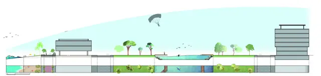
Reading highlights over the original drawing. The bands do not represent plot boundaries or construction dimensions.
A transition between scales
The section brings together the spaces presented so far in a single view. Low-rise development beside the beach relates to the environmental corridor of the park and canal; on the inland side, mixed-use blocks form the transition to the neighborhood.
The masterplan explores alternative building volumes and heights. These need to be coordinated with infrastructure, environmental comfort, landscape and applicable planning rules. The value of the section lies in making these relationships visible so they can be discussed before the buildings are developed in detail.
Chapter 04 / 06
The programs
A city that cares, educates and produces.
Neighborhood life is complemented by facilities for care, learning and work. Health, education, research and longevity broaden the urban program.
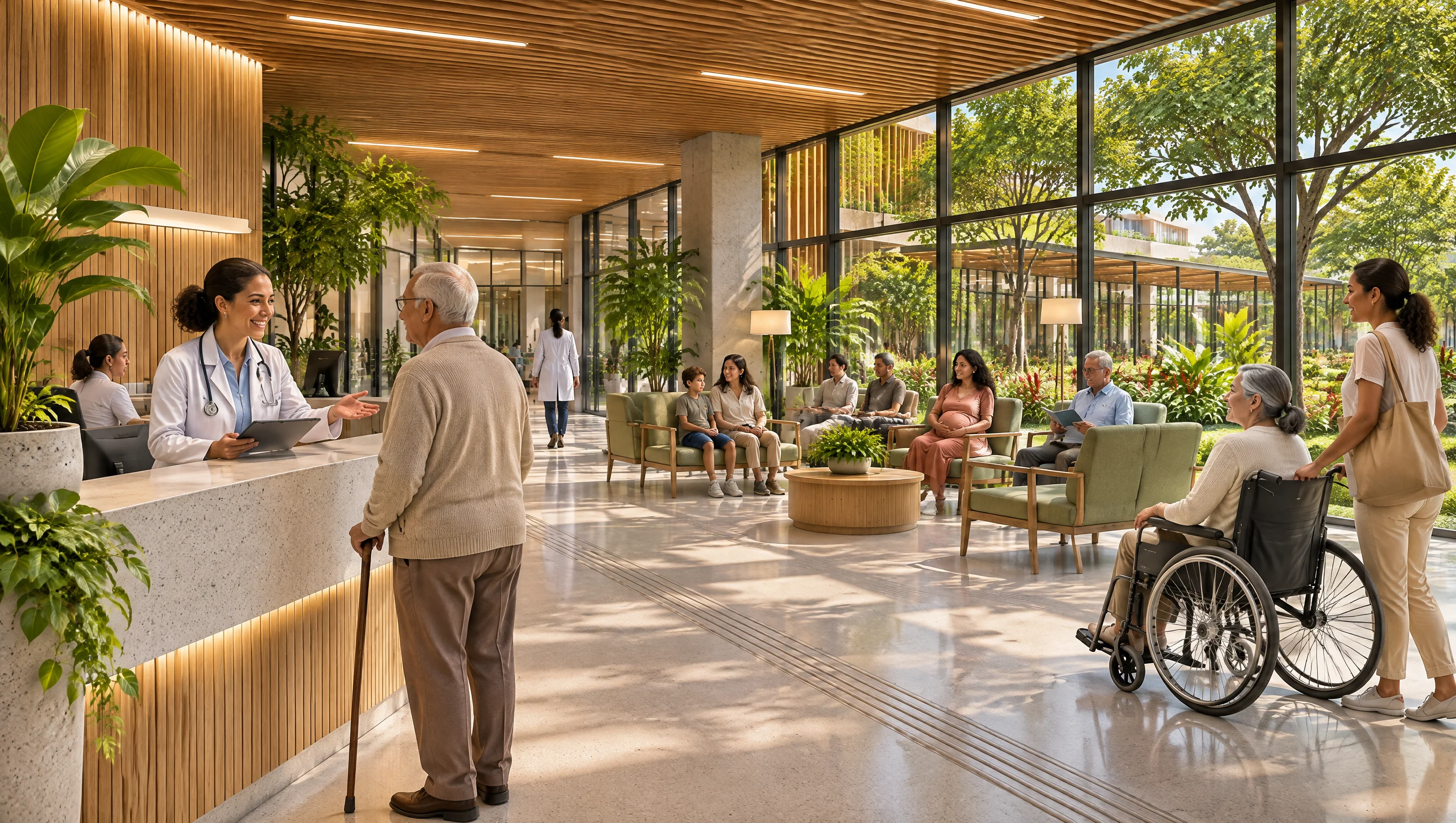
Care close to everyday life.
A hospital and specialized services broaden the urban program and bring care closer to residential areas.
Care · Specialized services · Welcoming spaces
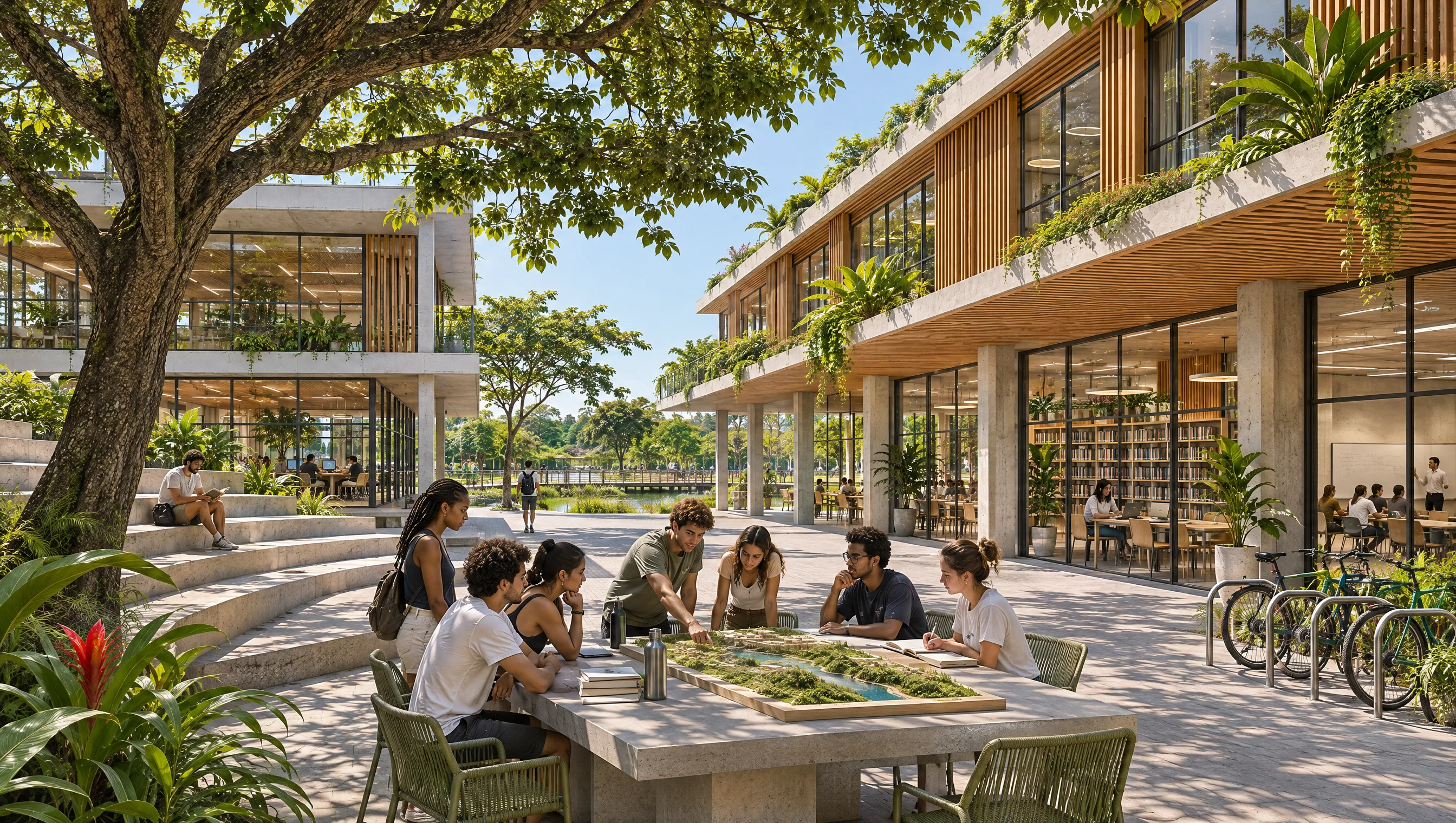
Learning, researching and generating knowledge.
University and technical education connect professional training, work and local development. The campus contributes to neighborhood life.
University · Technical education · Research
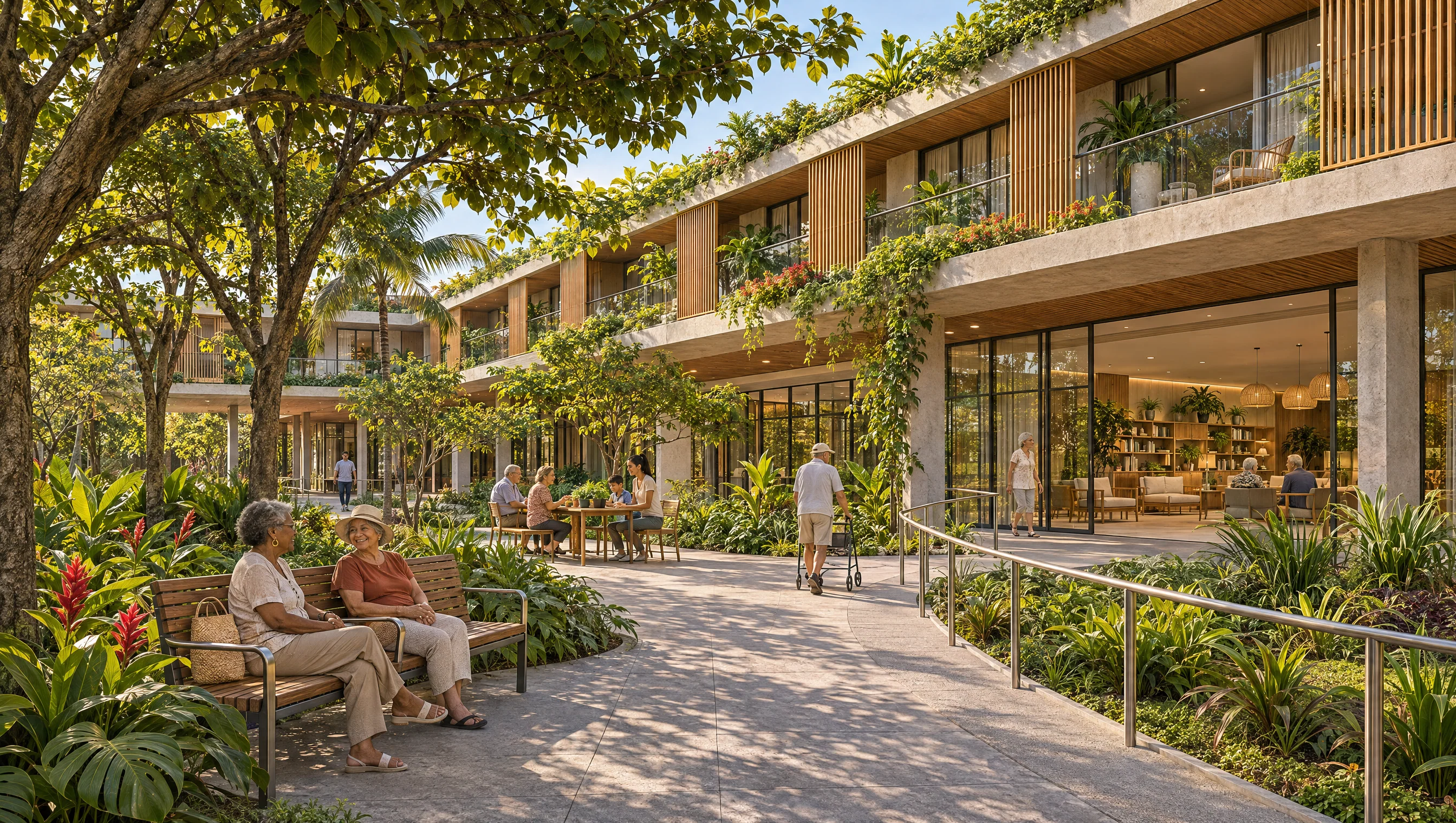
Senior living: independence and community.
The research identifies senior living as the most promising segment among housing options. Intended for older adults, it brings together housing, support services and social life, with accessible routes and opportunities to participate in neighborhood life.
Housing · Support · Community
Health, education and the longevity economy
Health, education and longevity-related services aim to create year-round activities, strengthen professional training and bring work and home closer together. The provision of services can also increase the capacity to care for residents of different ages.
The location, scale, operators and funding of these facilities still need to be defined. Within the masterplan, their role is to guide a diversified economic base, aligned with the population’s needs and the structure of urban space.
Knowledge rooted in the territory.
Education also addresses the territory’s challenges through studies of water, biodiversity and renewable energy.
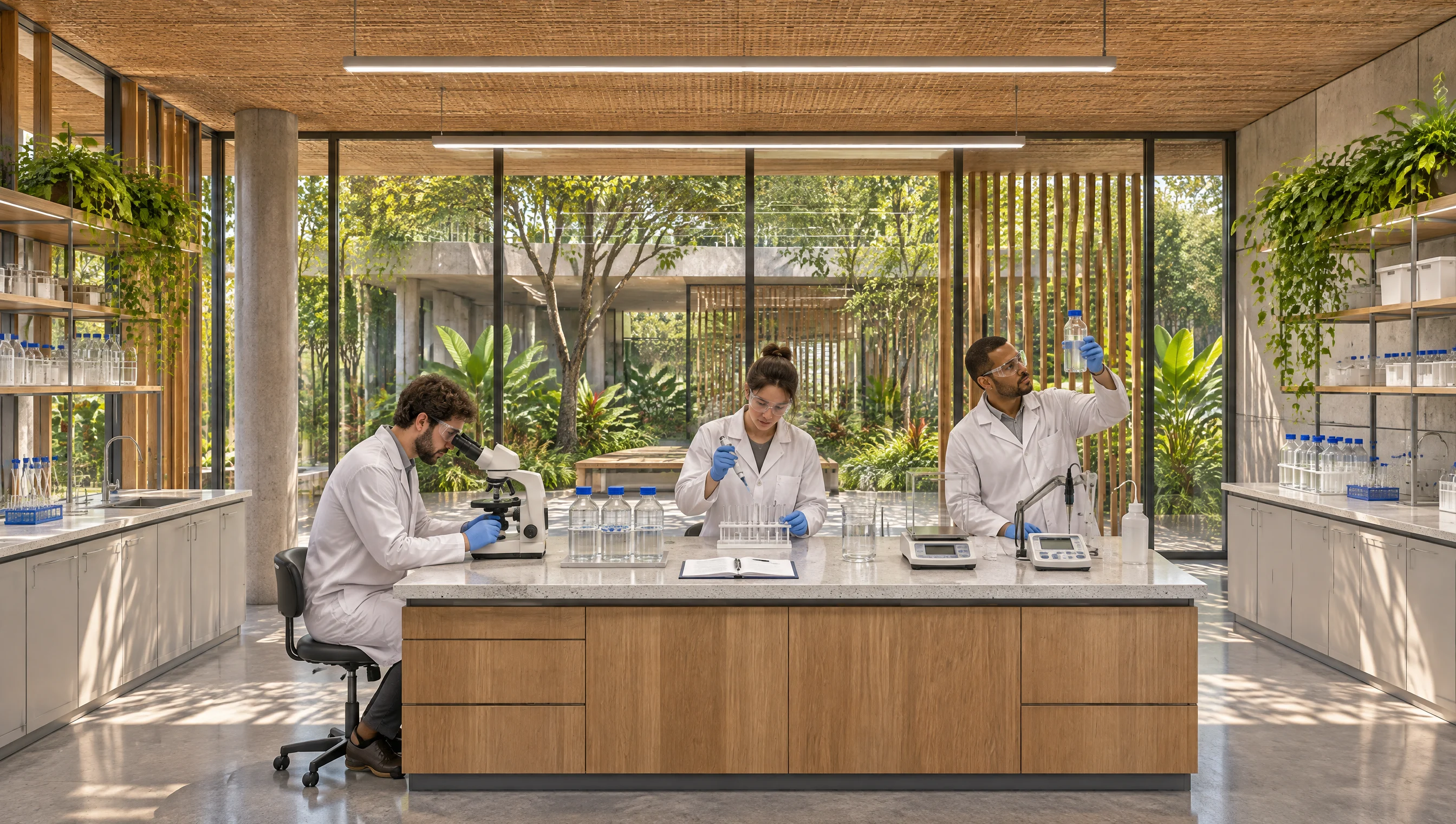
Research and environmental transition as opportunities
Oceanography, water management, coastal engineering, biodiversity, sustainable tourism and renewable energy are among the proposed research fields.
This agenda seeks to bring together educational and research institutions with economic activities. The canal, the waterfront and natural systems also become subjects for monitoring and the development of solutions.
This is a programmatic direction. Research facilities, partnerships and technologies require their own projects. Their relevance to the masterplan lies in the potential to connect professional training, local development and environmental care.
The economy also grows from the sea.
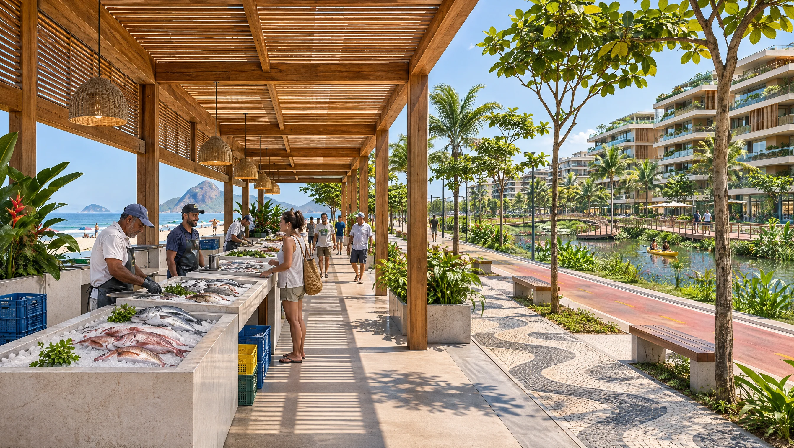
Alongside new services and research, the masterplan values activities already rooted in the place: fishing, the fish market, gastronomy, culture and tourism.
Fishing, gastronomy, culture and tourism
Support for fishing brings together a fish market or distribution center and gastronomy. A pier, marina, nautical activities and spaces for events and leisure broaden the economic and cultural program.
The recognition of the fishing community’s identity and the local economy needs to guide the definition of uses and their operation. The proposal can create opportunities for existing activities through access, supporting infrastructure and conditions for participation in the territory’s transformation.
Chapter 05 / 06
Implementation
From the overall vision to implementation.
To make the proposed spaces and programs viable, the masterplan brings together land reorganization, interventions by sector, and economic and institutional structuring.
Reorganize the land. Connect the spaces.
Browse the 13 frames to follow the reorganization of the banks, plots and new development.
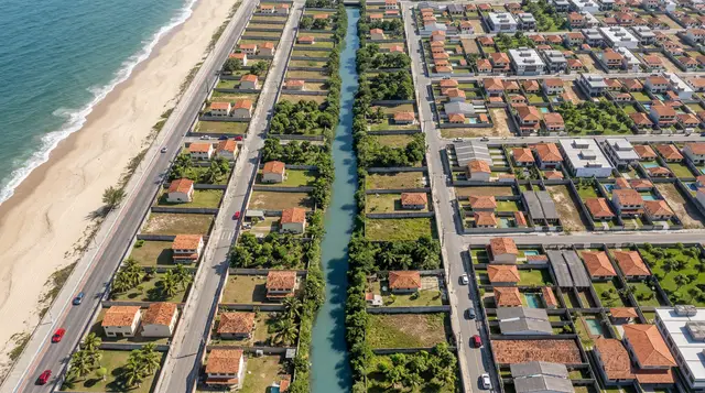

Conceptual representations of the masterplan, not a timeline of completed construction.
Land readjustment: reshaping relationships between plots and public space
Part of the study explores land readjustment, reorganizing plots and blocks to accommodate the new urban structure. The modeling sequence shows the restoration of the banks, the creation of connections and the gradual introduction of new building types.
This reorganization involves land ownership and social issues. The masterplan considers alternatives such as land exchanges and owners’ participation in development, as well as estimates related to expropriation. Each possibility depends on its own assessment, negotiation and clear rules.
The sequence should be read as a study. It demonstrates a logic of spatial transformation. The situation of each property and each family requires a survey, dialogue and a specific solution while the intervention is being structured.
Organize implementation by sector.
Priorities and further technical development
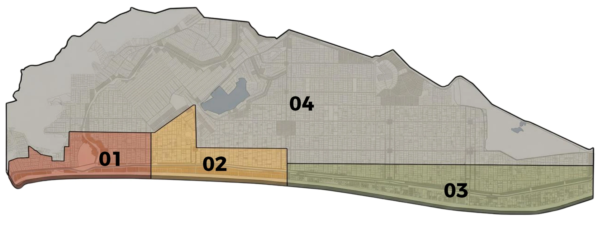
The masterplan organizes the transformation into four implementation sectors, with different locations and extents across the territory. This division allows priorities to be studied alongside the relationship between initial investments, environmental restoration and the expansion of interventions.
Topographic surveys, ground investigations, bathymetry, environmental studies, impact assessments, public participation and coordination with existing projects form part of this process. The implementation sequence must be adjusted to the feasibility and needs of each sector, keeping the neighborhoods functioning during the interventions.
Consolidate the foundation
Surveys, assessment, environmental studies, property records and public participation.
Structure implementation
Urban scenarios, infrastructure, facilities, and economic and legal models.
Implement and monitor
Detailed design, construction by sector, operation, maintenance and monitoring.
How the transformation can be structured
The study considers a Consortium Urban Operation, or OUC, as one of the instruments for implementation. The City Statute, in Articles 32 to 34, provides for its designation through a specific municipal law based on the municipal master plan, and for the participation of owners, residents, users and investors. The operation’s plan includes support for the affected population, a neighborhood impact study, contributions and shared oversight with civil society representation.
The legislation also allows the operation’s law to provide for Certificates of Additional Construction Potential, known as CEPACs. These are among the mechanisms that can link development rights to funding the planned interventions.
For Itaipuaçu, the masterplan investigates how planning instruments, public investment and private participation could support the transformation. Defining the model depends on coordinating urban guidelines, market capacity, social protection and institutional requirements.
Feasibility: building scenarios and testing their assumptions
The feasibility assessment considers costs, revenue, development capacity, visitor numbers and economic activity. The simulations test the relationships between investments, development and potential revenue over time.
These results depend on assumptions such as the pace of implementation, demand, reference values, operating costs and the participation of the stakeholders involved. Financial scenarios need to be reviewed and validated while the proposal is being structured. They do not represent funds raised or results already achieved.
The study also examines a park concession as an option for its implementation and management. In this case, the discussion needs to cover maintenance, service quality, public access, responsibilities and oversight, as well as projected revenue. Feasibility must consider the service life of the spaces and their day-to-day operation.
Chapter 06 / 06
The overall vision
The whole gives meaning to each part.
Preserving Itaipuaçu’s vitality gives meaning to the whole. Moderate increases in building height and density bring residents and activities closer together; the park, connections and infrastructure create the conditions for this urban life to be sustained.
Planning from the place itself
For Arsenic, this work expresses an approach to territorial planning: understanding the relationships that already exist in a place and building a vision of the future in which architecture, public space and infrastructure can work together.
Nova Itaipuaçu is a conceptual study of urban transformation. Images, sections and simulations present the masterplan’s vision and the proposed spatial atmospheres. Implementation depends on further technical development, public participation, structuring, funding and permits.