The first article ended with a question. This is the answer.
The opening of this series argued a thesis that is simple to state and hard to accept: subdividing captures less value than programming, because it liquidates the asset instead of making it work. The sold lot pays once. The destination pays every year. The text closed with the question that came naturally after it, and that is the first of all: how to know, looking at a specific farm, what kind of destination it calls for.
A month later, the territory answered before we did. On January 15, 2026, Governor Cláudio Castro signed the Lei estadual nº 11.104 (State Law No. 11.104), published in the state's Official Gazette the following day. It was born from Bill 6.345/25, originally authored by state representative Rodrigo Amorim, approved in a single reading by the Legislative Assembly on December 18, 2025. The law created the Serra do Rio designation of origin for the wine products of the Serra Fluminense.
A wine seal does not usually change the value of a farm. This one does, and not for the reason it seems. Because the designation is not an agricultural policy. It is an instrument of meaning. It gives a piece of mountain a name the market recognizes, and a name is the raw material of any destination.
They created a designation of origin for a territory that was never measured
Look for the size of the Serra do Rio and you will not find it. There is no survey by AVIVA, by Emater-Rio, by Pesagro, by the state Secretariat of Agriculture or by IBGE (the Brazilian Institute of Geography and Statistics) saying how many hectares of grape exist inside the designation. The figure in circulation, of a little over 85 hectares and around 30 ventures, comes from a single report by the Diário do Rio de Janeiro, from September 2025, with no agency attributed, and written about a different bill, the one for the "Serra dos Vinhedos", which never even became law. We repeated that figure in the previous issue of this series, as almost everyone repeated it. It has no official backing.
And that is not a defect of the coverage. It is the most revealing piece of data there is about the region.
They created a designation of origin for a territory whose planted area nobody measured.
If the business were wine, someone would already have counted the bottles.
A state that legislates on the origin of a product without first sizing the production is not protecting a crop. It is naming a territory. And territories get named when what one intends to sell is not what comes out of the land, but the fact of being on it.
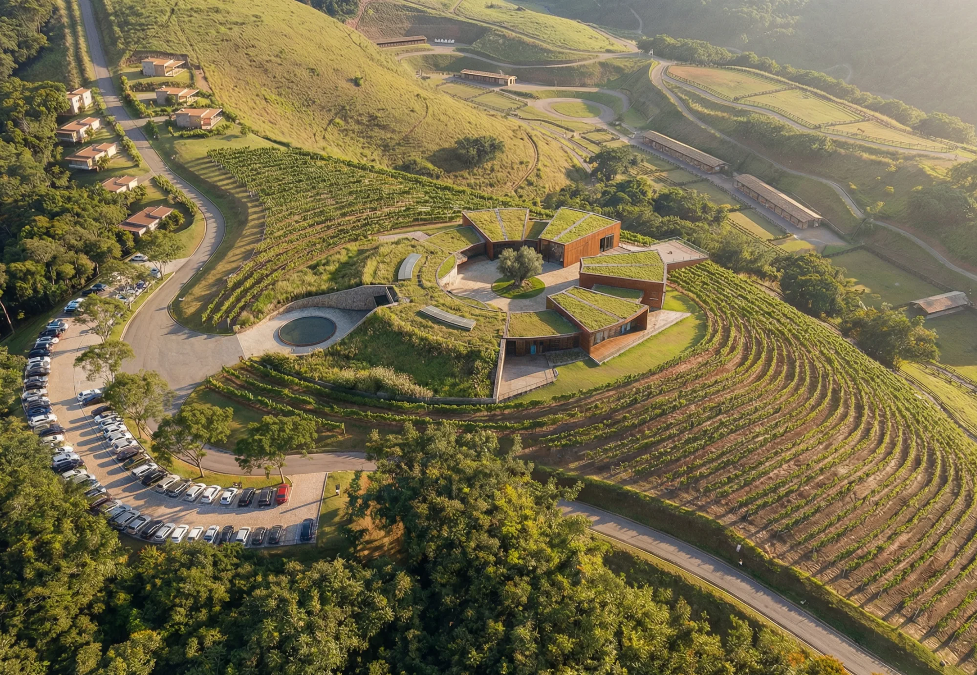
The houses of the region say this themselves in the way they organize. Borgo Del Vino, in Areal, with around 8.5 hectares of vineyard, does not sell in supermarkets: it sells inside its own complex, which brings together vineyard, hotel, restaurant, pizzeria and wine cellar. Wine tourism is not the accessory of the business, it is the business. Maturano, in Teresópolis, opened to the public in October 2025 and earned national press coverage for its architecture, not for its harvest: CNN called it a cinematic winery and described two pavilions designed to respect the mountainous, granitic topography. Tassinari, in São José do Vale do Rio Preto, makes the view of the valley its central argument, and is the only one in the Southeast to plant Vermentino.
Notice the pattern. In none of these cases is it the liter that attracts. It is the place.
It does not generate the revenue. It authorizes the revenue.
It is worth separating two things that are usually said together. A farm with a vineyard produces wine. A farm with a designation of origin produces meaning. They are different operations, and only the second changes the value of the asset.
The designation does three things for a property, and none of them go through the bottle. First, it gives the place a name: an anonymous rural address comes to belong to a recognized region, with a boundary defined in law. Second, it gives a reason to travel: nobody drives two hours to see a pasture, but they do drive to taste a high-altitude wine. Third, it gives narrative: winter harvest, granitic hillside, dupla poda (double pruning). Each of these terms is a sentence the guest repeats when they get home.
This is the same mechanism of the archetype that the first article in this series had already identified. The Vale dos Vinhedos, in the Serra Gaúcha, was the first recognized Geographical Indication in Brazil, with an Indication of Provenance in 2002 and a Denomination of Origin in 2012, delimiting 81.23 km² among Bento Gonçalves, Garibaldi and Monte Belo do Sul. The wine came first and the destination organized itself around it. The Serra do Rio is repeating that sequence almost a quarter of a century late, and with an advantage the Serra Gaúcha never had: it is born already glued to two of the largest consumer markets in the country.
Two caveats of honesty, because they matter and almost nobody makes them.
The first: the designation created by the Lei 11.104/2026 is a state one, managed by the State Secretariat of Agriculture. It is not equivalent to a Geographical Indication (GI) registered with the Instituto Nacional da Propriedade Industrial (INPI, the National Institute of Industrial Property). Art. 4, III of the law itself provides for partnerships with the Ministry of Agriculture and with the INPI aiming at future protection by geographical indication. That is: the GI is a declared objective, not an accomplished fact. Whoever treats the seal as if it were already a registered GI is getting ahead of a step the law did not take.
The second: art. 1 certifies products made with grapes grown and/or processed in the region. The "and/or" is not a drafting detail. It means that growing in the region or processing in the region is already enough for the label. For anyone who owns land, that widens the game considerably.
Six questions before the first construction
Land is not evaluated by the hectare or by the price. It is evaluated by suitability, and suitability is a sequence of questions that can be answered before any investment, with a survey, a contour line and a reading of the legislation. These are the six we ask.
1. Is the farm on the list?
The designation is a state one and it has a boundary. Art. 3, §1 of the law delimits the region covering at least 26 municipalities, among them Petrópolis, Teresópolis, Areal, Três Rios, Paty do Alferes and Paraíba do Sul, and leaves the list open to others that come to be recognized as part of the serrana wine region. Outside that boundary there is no Serra do Rio label, however good the land may be. It is the cheapest question to answer and the one most people skip. A neighborhood warning is in order: the same technique has produced competing labels that are not to be confused with this one, such as the Vinho da Mata in the Zona da Mata of Minas, the Serra dos Encontros on the border of Minas with São Paulo, and the Serra da Mantiqueira. A state law of Rio does not reach Minas.
2. Does the altitude help?
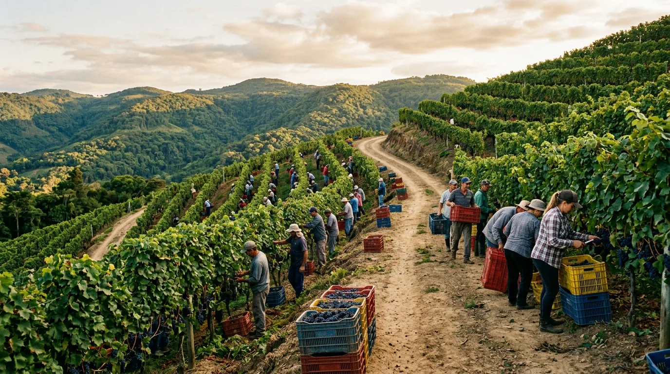
All the fine wine of the Southeast depends on one technique: the dupla poda, or inverted pruning, developed and validated by Epamig. It inverts the vine's cycle and throws the harvest into the dry winter, when there is little rain and a large temperature swing between day and night. In outreach material, Epamig advises choosing regions with an altitude between 600 and 1,000 meters, and records that this band varies as a function of latitude. It is not a rigid requirement, and it is not a ceiling: the institution itself points to winter wine production at higher altitudes in the north of Minas Gerais and in the Center-West. Treat your farm's elevation as a strong indicator, not as a sentence.
3. How does the hillside behave?
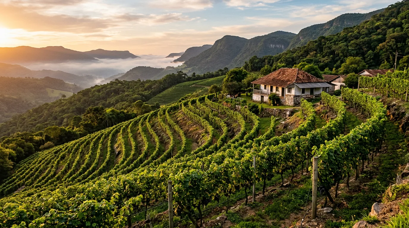
Here the question stops being agricultural and becomes a design question, and here there is a number. Embrapa Uva e Vinho does not recommend establishing a vineyard in areas with a slope greater than 20%, because establishment becomes more expensive with conservation practices and cultivation work becomes difficult. Above 5% of slope, erosion control measures are already required, such as contour planting and terraces. On non-flat relief, the recommendation is mid-slope: the lowland accumulates cold air and brings a risk of late frost, the hilltop catches wind. For temperate climate, Embrapa further recommends the north face, for the greater sun exposure and the lower incidence of cold winds from the south, and where that is impossible, northeast or northwest, avoiding the south face.
Two caveats. This guidance is from Embrapa Uva e Vinho, based in Bento Gonçalves, and it is general in character: it is not a norm specific to the Southeast, and the north face recommendation comes explicitly qualified for temperate climate regions. And the 20% limit is economic and about management, not legal: do not confuse it with the 45º of the Código Florestal (the Brazilian Forest Code), which is another thing and another unit. The point for anyone who owns land is that the same incline that decides the vine rows decides where one can build, how much each meter of access costs and where the water crosses the property. A hillside good for grape is not automatically a hillside good for a building, and the two readings need to be made together, on the same contour line. Maturano resolved this explicitly, with two pavilions designed to respect the granitic topography instead of flattening it. It is a design decision, not an earthworks decision.
4. Where is the water, and what does it protect?
A watercourse is a landscape asset and a legal restriction on the same line of the drawing. The Código Florestal, the Lei 12.651/2012 (Federal Law No. 12.651 of 2012), defines as Área de Preservação Permanente (APP, Permanent Preservation Area) the riparian buffers of any natural watercourse, perennial and intermittent, ephemeral ones excluded, measured from the edge of the regular bed channel, with a minimum width of 30 meters for rivers less than 10 meters wide, rising by bands up to 500 meters for the largest ones (art. 4, I). Also APP are hillsides with a slope greater than 45º, equivalent to 100% on the line of steepest descent (art. 4, V), the tops of hills and mountains with a minimum height of 100 meters and an average incline greater than 25º, counted from the contour line corresponding to two thirds of the height (art. 4, IX), and areas above 1,800 meters (art. 4, X). Add to that the Reserva Legal (legal forest reserve): outside the Amazônia Legal (the Legal Amazon), 20% of the area of the rural property (art. 12, II). None of these polygons is negotiable in the sketch, and all of them appear early in the survey. It is much cheaper to discover them before than after.
5. Can you get there?
Wine tourism is logistics before it is experience. A destination needs access that accepts buses and vans, parking sized for the weekend peak and a door-to-door time that fits into a Saturday leaving from Rio or from Juiz de Fora. A vineyard without access is not a destination: it is a crop with a view. It is the criterion that eliminates the most beautiful farms. And this is where the warning comes in: lodging and restaurants on rural property go through municipal zoning and licensing, which change from municipality to municipality. That conversation is with the city hall and with a lawyer, before the drawing, not after.
6. Does what is already built work?
Most of the large farms of the region carry an old main house, granaries, corrals and sheds. Reusing a main house as a restaurant, emporium or wine cellar changes the investment math and delivers for free the hardest thing to build from scratch: age. A farm manor has a backing no new building can buy. It is the item that most often decides feasibility.
| Criterion | Objective question | Reference |
|---|---|---|
| Eligibility | Is the municipality among the 26 delimited? | Lei 11.104/2026, art. 3, §1 |
| Altitude | Is the elevation close to the 600 to 1,000 m band? | Epamig guidance |
| Hillside | Slope below 20%? Mid-slope? | Embrapa Uva e Vinho, Documentos 75 |
| Water | Where do the APP and the Reserva Legal fall? | Lei 12.651/2012, arts. 4 and 12 |
| Access | Does a bus get there? Can it park? Does it fit into a Saturday? | Municipal zoning and licensing |
| Pre-existing fabric | Can the main house and the sheds become program? | Cadastral survey |
None of these six questions requires construction to be answered. All of them require reading. That is why the diagnosis comes before the drawing, and the drawing comes before the deed.
A project underway, and a portfolio that is not from today
We are not writing this from the outside. Arsenic has, at this moment, a project underway for a large farm inside the Serra do Rio. By agreement with the client we do not identify the property or the municipality, but the program can be described, because that is what interests the reader: main house and adjacencies, guest house, gourmet area, wine cellar, spa, emporium and cheese dairy, articulated with a winery, with the vineyard and with a set of lodging distributed across the hillside, with a stud farm, glamping, an events space and planting areas. It is the farm as a destination leaving the argument and becoming a drawing.
And it is worth saying what this masterplan teaches, because it contradicts the lazy reading of this series. There are lots inside it. The first article did not say that subdividing is wrong: it said that subdividing without programming liquidates the asset. When the subdivision is born inside a destination that already has a winery, an emporium and events, it stops being the liquidation of the farm and becomes one of its revenues. The lot is worth more because the destination exists. That is the synthesis the drawing allows and the spreadsheet alone does not see.
The territory, that one we have known since before the wine. Arsenic has been designing in the Região Serrana for years, and a good part of that production is inside the municipalities the Lei 11.104/2026 delimited. In Areal, locally recognized as the state's grape capital, we signed the Hospital Municipal, the Praça Barateza, the Rua do Rock, the Parque Julioca and the Unidade de Saúde da Família do Centro, the family health unit of the town center. In Paty do Alferes, the masterplan for the municipality's tourism development. In Três Rios, the Centro Cultural. In Petrópolis, the Escola Municipal Cachoeirinha, in the district of Itaipava. These are public works, of public record, and that is the difference between knowing the region and having an address in it.
Reading the hillside, reading the law and reading what is already there is what we do before drawing. The Serra do Rio designation has only made that work more valuable for anyone who owns land.
The question worth a farm
If you own a large property in the Região Serrana, the decision in front of you is not between planting grape and not planting. It is between liquidating the land in lots and programming the land as a destination, knowing that there is now a state seal capable of giving a name to whatever you do there.
The six questions in this article are answered with a survey, a contour line and a reading of the legislation. They cost a fraction of what it costs to discover the wrong answer after the earthworks. And they precede any conversation about investment, because they define what the land accepts being.
The next article in this series goes into the program: which facilities anchor the visitation, in what order they come in and how a rural destination is sized without turning it into a theme park.
Sources consulted
All URLs verified on July 16, 2026.
- Rio de Janeiro (state), Lei nº 11.104, de 15 de janeiro de 2026 (State Law No. 11.104, of January 15, 2026), full text.
- ALERJ (Rio de Janeiro State Legislative Assembly), signing of the law and creation of the Serra do Rio designation, January 16, 2026.
- ALERJ, approval of Bill 6.345/25 in a single reading, December 18, 2025.
- Brazil, Lei nº 12.651/2012 (Federal Law No. 12.651 of 2012), Código Florestal (Forest Code), arts. 4 and 12, Planalto.
- SILVEIRA, S. V.; SANTOS, H. P. Planejamento de vinhedos e escolha da área para implantação (Vineyard planning and choice of the area for establishment). In: Implantação e manejo de vinhedos de base ecológica. Embrapa Uva e Vinho, Documentos 75, 2011, p. 11-16.
- SILVEIRA, S. V.; LEÃO, P. C. de S. Implantação do vinhedo (Establishing the vineyard). In: Produção Integrada de Uva para Processamento, v. 3, Embrapa.
- Epamig, dupla poda (double pruning) of the vine and altitude guidance, reproduced in Revista Rural, October 4, 2021.
- Diário do Rio de Janeiro, September 26, 2025, the only source located for the figures of 85 hectares and 30 ventures.
- BarraUp, Borgo Del Vino, Syrah and its own complex in Areal.
- CNN Brasil, Maturano winery and the two pavilions over the granitic topography.
- Viagens e Andanças, Tassinari winery and the Vermentino.
- Vinhos com Fernando Lima, Areal as the grape capital.
- Vinícola Guaspari, technical explanation of winter wines and of the dupla poda.
- Embrapa Uva e Vinho, Vale dos Vinhedos, IP 2002, DO 2012, 81.23 km², referenced in Issue 022.
- Diário do Rio, Região Serrana declared State Capital of Wine, April 9, 2026.
Updated on July 16, 2026.
Declared pending items. This article corrects the previous issue of this series on three points. First: there is no official source for the planted area or for the number of ventures of the Serra do Rio. The figures of 85 hectares and 30 houses were located in a single report, with no agency attributed, written about a bill different from the one that became the Lei 11.104/2026, and for that reason they appear here only in attributed form, never as official data. Second: the law delimits, in its art. 3, §1, "at least" 26 municipalities, and not 27. Third: there is no primary source sustaining the altitude of the region's vine plots at around a thousand meters, and the available sources show dispersed altitudes, which is why no average is asserted. The altitude guidance of 600 to 1,000 meters comes from Epamig outreach material whose official page is offline, surviving in press reproduction, and the reproductions diverge as to the researcher cited, which is why no name is attributed to the sentence. The slope and hillside face recommendations are from Embrapa Uva e Vinho, general in character and based in the Serra Gaúcha, and do not constitute a norm for the Southeast. The property that is the object of the project cited in section 05 is not identified, by agreement with the client, and for that reason no metric of it is asserted. No figures for revenue, ticket, visitation or return were asserted for any winery in the region, for lack of a primary source.